GR®10: La Grande Traversée des Pyrénées
Do you dream of surpassing yourself and experiencing an unforgettable adventure in the heart of the Pyrenees? The GR10 offers you a memorable crossing, but its preparation requires special attention.
This article reveals thedetailed itinerary, milestones and practical information you need to successfully complete your hike between Hendaye and Banyuls. On the program: iconic passes, cosy refuges and breathtaking scenery. But be warned: transforming your desires into real experience means getting to grips with the demanding trails of this legendary crossing. Where to start?
Contents
- Discovering the GR® 10
- Preparing your trip
- Breakdown of key stages
- Accommodation and budget
- Alternatives and expert advice
- Orientation and safety
- Turning the route into an adventure
- Additional resources
Discovering the GR® 10
A mythical route through the Pyrenees
The GR® 10 is more than just a signposted trail: it’s a real immersion in the wild landscapes of the Pyrenees. This long-distance hiking trail crosses the mountain range from west to east, linking Hendaye to Banyuls-sur-Mer. But what exactly makes it so special? First and foremost, its ability to adapt to the varied terrain – steep passes, dizzying peaks and peaceful lakes follow one another day after day.
Imagine yourself here, backpacked, progressing between the Atlantic and the Mediterranean. The route reveals ever-changing panoramas: the deep forests of the Basque country, the windy plateaus of the Ariège region, then the famous stony paths of the Eastern Pyrenees. Every refuge we come across is a welcome stopover, especially when the clouds cling to the ridges. Note that the total distance is around 900 km – enough to satisfy any desire for personal achievement!
- Legendary passes: L’Aubisque, Marie-Blanque… These names evoke as much effort as visual reward. Passing them marks key milestones, with a new setting unfolding each time.
- Remarkable summits: the Pic du Midi d’Ossau dominates Béarn with its unique silhouette. Further east, the Vignemale impresses with its persistent glacier – a sight that in itself justifies a few detours.
- Mountain lakes: Gaube, Oô, and the Bouillouses lakes… Refreshing breaks where hikers can catch their breath before the sapphire-colored waters.
- Authentic villages: From Saint-Jean-Pied-de-Port to Banyuls, urban halts offer a welcome contrast. You’ll often find old shacks restored as gîtes, perfect for a comfortable night’s sleep.
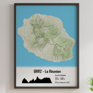
Our personalized hiking souvenirs:
Preparing for your mountain adventure
This Pyrenean route requires serious preparation. The daily gradient varies considerably from section to section – so it’s best to study the profiles carefully before setting out. Did you know that some stages have climbs of over 1500 m? A good level of fitness is essential, especially with a heavy pack.
The weather brings its share of unforeseen challenges. In high season, thunderstorms often break out in the afternoon, so it’s best to leave early and bring a makeshift shelter. As for the persistent snow on certain passes, crampons are sometimes required, even in summer. Before setting off, it’s always a good idea to check conditions in the huts. Guarded huts provide invaluable information on trail conditions.
Choosing the right equipment is crucial for these long distances. Choose well-tried shoes and a well-fitting pack. Walking poles will soften the impact of steep descents. Finally, don’t forget that each valley has its own variants – to be adapted according to your desires and accumulated fatigue. The GR®10 has to be earned, but how satisfying to finally catch a glimpse of the Mediterranean after weeks of effort!
Preparing your trip
Essential equipment
Organizing your hiking bag for the GR10 requires special attention if you are to enjoy this Pyrenean adventure. The equipment you choose directly conditions your experience, whether in terms of comfort or safety. An ill-fitting bag or unsuitable footwear can spoil your enjoyment. Here are a few seasonal benchmarks in the form of a comparative table:
| Equipment | Summer | Winter |
|---|---|---|
| Clothing (base layers) | Technical T-shirts (2-3, 100-150g/pc) | Thermal underwear (2-3, 150-250g/pc) |
| Clothing (middle layers) | Light fleece (200-300g) | Warm fleece (400-600g), Down jacket (400-600g) |
| Clothing (outer layers) | Light waterproof jacket (300-400g), Convertible pants (300-400g) | Reinforced waterproof jacket (500-700g), Warm waterproof pants (500-700g) |
| Shoes | Hiking low/mid (800-1200g/pair) | Waterproof mountain boots (1200-1600g/pair), crampon compatible |
| Sleeping bag | Comfort 5-10°C (600-1000g) | Comfort -10 to -20°C (1200-2000g) |
| Tent | 2-seater lightweight (1500-2500g) Discover our selection of tents at the best price | Heavy-duty 4-season (2500-4000g) |
| Specific accessories | Hat/cap | Crampons (800-1200g/pair), Ice axe (400-600g), Sunglasses (UV protection) |
| Indicative total backpack weight | Under 12 kg | Up to 15 kg |
Legend: This comparison table gives an estimate of the equipment recommended for the GR® 10 in summer and winter. Weights are given as a guide and may vary according to make and model. Adapt your equipment according to your experience and expected weather conditions.
Lightening your pack can sometimes be a headache, but it’s a decisive factor when it comes to enjoying the passes and lakes of the Pyrenees. Every kilo you lose is felt on the trail, especially as the gradient increases. Choose multi-purpose equipment: a water bottle with a filter means you don’t have to carry several liters, and a convertible jacket serves as a wind and rain cover.
Adapted physical preparation
The GR10 between Hendaye and Banyuls puts the body to the test. Gradual training over 3 months allows you to get your muscles and joints used to the specific nature of the terrain. But how do you develop endurance without premature wear and tear? And above all, how do you protect your knees on stony trails?
To strengthen the legs, alternate uphill walking with proprioception exercises. Working on balance on an unstable foot prepares you for technical passages near refuges. As for stretching, it should be an integral part of every outing – after the effort, of course.
An effective workout reproduces real-life conditions. Wear your weighted pack during repetitions, gradually increasing distance and weight. On steep peaks, every muscle counts. Don’t forget to test your shoes on a variety of terrains: slippery rocks near huts, damp grass on lakeshores, or sandy Mediterranean paths.
Finally, listen to your desires while remaining reasonable. An extra break at a sunny pass? Sometimes better than being relentless. An early start in the morning often helps avoid high-altitude thunderstorms. With this approach, your joints will be better able to withstand the estimated 50-day crossing.
Breakdown of key stages
Western Pyrenees
The western Pyrenean sector marks the start of this great crossing. The first few days of walking in the Basque Country immerse you in a rich and authentic culture. The Basque country reveals its many facets. But where can you find refuges to rest after a long day on the trails?
Crossed by the GR®10, this area is full of typical villages where authenticity persists, allowing hikers to refuel while discovering a living heritage.
- Hendaye: The official departure point, this coastal town has everything you need to prepare for your adventure. Make the most of it before tackling the first Pyrenean passes.
- Sare: One of France’s most beautiful villages, its narrow streets are home to grocery stores selling local produce and cheese specialities. A gourmet stop-off before the steep trails.
- Ainhoa: Its white and red Labourdine houses house craftsmen and small shops. A good opportunity to load up your bag with provisions for the high altitude lakes to come.
- Saint-Jean-Pied-de-Port: A historic stopover on the road to Arles, this medieval town offers services and accommodation. There’s also a covered market where you can stock up before heading off to the mountain huts.
- Bidarray: This stopover village has a convenient Intermarché. The Menditarrena gîte is often used as a base for hikes to the Pic d’Orhy or other Basque peaks.
These village stops, with their shops and traditions, are an essential link for those who want to enjoy the distances of the GR®10 while discovering the region.
Crossing the central Pyrenees
The central zone of the GR10 reveals another facet of the Pyrenees. Passing through the National Park becomes a sensory experience. Imagine paths winding between glacial lakes and dry-stone huts, with vultures soaring over the passes.
Created in 1967, the National Park preserves a remarkable ecosystem where isards, marmots and birds of prey cohabit. The beech forests are home to deer and wild boar, while the summer pastures are a reminder of a pastoral life that is still active. This section of the trail alternates between ascents to breathtaking peaks and descents to unspoilt valleys. Hikers here discover the art of balancing effort and desire, between the desire for performance and the need to conserve strength for the distances to be covered. Each bend reveals a new panorama: sometimes a shimmering lake beneath the ridges, sometimes a refuge clinging to the mountainside. Villages such as Cauterets and Luz-Saint-Sauveur offer a chance to recharge your batteries before tackling the technical sections on the way to Banyuls, the walkers’ ultimate goal. The backbone of the route, this central section is as demanding as it is awe-inspiring. It will always be remembered for its contrasts and its ability to satisfy the most varied desires of mountain lovers.
Accommodation and budget
Hosting solutions
Organizing your accommodation is a key factor in preparing for your GR10 crossing of the Pyrenees. Between mountain refuges, stopover gîtes and campsites, each option offers a compromise between comfort, cost and autonomy. Let’s take a look at how you can reconcile your desires and your wallet while enjoying the emblematic lakes and passes. Here are the average rates:
A mix of bivouacs and refuges is a good way to lighten the bill. Bivouacs – which are free if you respect local rules – contrast with the sometimes expensive half-board accommodation. By alternating 3 nights in a tent near a lake and 1 in a refuge after a demanding pass, you can manage both your bag (less food to carry) and your budget. But where to pitch your tent? Some areas near pastoral huts prohibit it. Here’s a tip? Take advantage of the refuges without sleeping in them: paid shower here, hot meal there, while keeping your freedom.
Equipment has a direct influence on this equation. A good comforter and a light tent are worth the investment for those who prefer wilderness trails. For a couple, a night in a refuge on a half-board basis costs €90, while bivouacking saves around €60 per night (including the cost of food). The result? An overall budget of between €1,000 (predominantly bivouac) and €2,000 (systematic comfort). It’s worth pointing out that some people prefer to reserve a few key stages – near the Pic du Midi d’Ossau or before arriving in Banyuls – to take a breather in a real bed. It all depends on what you’re looking for: isolated trails or friendly rest stops?
Alternatives and expert advice
Spanish GR® 10 vs GR® 11
The GR10 and GR® 11 are two major options for crossing the Pyrenees, but their profiles differ significantly. Let’s take a look at what sets them apart. The GR10 runs entirely on the French side, linking Hendaye to Banyuls-sur-Mer over a distance of almost 866 kilometers. Its Spanish counterpart, the GR® 11, covers 840 kilometers between the Atlantic and the Mediterranean. What makes it special? The Iberian side of the trail offers a wide variety of landscapes: Atlantic forests, high limestone peaks and Mediterranean pine forests. The GR10, more wooded, offers sometimes repetitive passages between passes and valleys – a point to be considered depending on your desire for discovery. On the practical side, it’s worth pointing out that French signposting is generally easier to read, especially for the uninitiated. Another notable difference is accommodation. The refuges and cabins of the GR® 11 often help to keep costs down, whereas the GR10 favors village stages. Choose the latter to observe a wide variety of fauna as you cross forest switchbacks. On the other hand, the GR® 11 includes sections in common with the HRP, ideal for lovers of grandiose panoramas.
Feedback
What can we learn from the testimonials of walkers who have trodden the GR10? First of all: 90% of the difficulties are due to inadequate preparation. Take equipment, for example. How many beginners neglect to break in their shoes before setting off! A simple pass with blisters can turn into a real ordeal. Another common pitfall is underestimating the actual distance between refuges. Some stages have a lot of elevation gain and rocky paths – so it’s best to consult the topographical guides carefully. It’s also important to adapt your pace: trying to imitate the performance of the regulars on the Pic du Midi d’Ossau is a recipe for exhaustion. Sound advice? Test your equipment on short hikes near a lake or in the mid-range mountains before taking the plunge. Above all, build your itinerary according to your actual physical abilities. Remember that a complete traverse takes 40 to 50 days, with essential rest days. Those in a hurry will opt for key sections between passes and high-altitude huts, to reconcile pleasure and effort.
Orientation and safety
Modern navigation tools
Correct orientation is essential to enjoy your adventure on the GR10. Combining a paper map with a mobile app is a smart way to anticipate difficulties and adjust your progress. IGN (Institut Géographique National) maps provide reliable topographical details of the Pyrenees massif, including the official route of the trail, passes to be crossed and water points such as lakes. Available in both physical and digital versions, they allow you to visualize relief, secondary paths and refuges. On the digital side, GPS applications even work offline – an advantage near isolated peaks. They indicate remaining distance, altitude difference and stopover huts. The Asso des Amis GRdistes offers verified GPX tracks, useful for following the trail. If you’re in doubt at a crossroads, cross-referencing GPS data with the IGN map can avoid many mistakes: contour lines and lakes that can be spotted on paper confirm your position. For example, once you’ve climbed a demanding pass, consulting your map will help you find the nearest refuge or the path leading down to a lake. The GR10, with its 900 kilometers and 55,000 m of total ascent, demands this kind of vigilance – especially in the wooded sections where the GPS can falter. It’s worth remembering that each stage requires preparation adapted to the individual’s wishes and abilities. Near steep peaks or windy passes, a mistake in orientation can unnecessarily lengthen the distance covered. Tip: mark refuges and permanent water points on your map. This allows you to adjust your route according to the mood of the moment – a break near a lake or a night in a guarded hut. In short, the art of navigating this legendary trail relies on a balance between modern tools and a careful reading of the Pyrenean terrain.
Turning the route into an adventure
Variations to suit all tastes
The GR10 is much more than a classic itinerary: it’s a unique opportunity to shape your Pyrenean experience. Rather than strictly following the route, why not consider escapades to isolated lakes or little-known passes? Mountain huts are a regular feature of the landscape, offering strategic stops to adapt the distances covered.
The beauty of this traverse lies in its flexibility. For example, you can choose short sections between two refuges, or lengthen the effort to reach a secondary peak. Some even prefer to combine this route with parts of the Camino del Norte – an interesting option for extending the adventure all the way to Santiago de Compostela.
And let’s not forget the logistical aspect: bivouacs allow you to vary the stages as you wish, while secondary trails avoid busy areas. Between Hendaye and Banyuls-sur-Mer, each day becomes a balance between physical effort and contemplation of the distant Mediterranean. The key? Adapting your pace to the difference in altitude while savouring the panoramic views – a philosophy that transforms hiking into an art of living.
Additional resources
To prepare for your GR10 adventure, it’s best to gather all the information you need. A good place to start? The official topo-guides and specialized forums are full of practical advice. The Fédération Française de Randonnée Pédestre (FFRandonnée) publishes guides covering the entire route, from the start in Hendaye to the finish in Banyuls. These are indispensable references for organizing your progress between passes and refuges.
The indications on walking times provide an objective basis, but it’s best to understand how they are calculated. Four official guidebooks detail the entire route, with precise information on huts and watering holes. A detail that counts: the Association Les Amis Gr’distes offers a “pass’port” to be stamped at the refuges to validate your crossing.
Take, for example, the topoguide covering the section from Hendaye to Arrens (260 kilometers): it describes each stage.
Did you know that the total distance varies from source to source? Officially, the GR10 stretches 1,100 kilometers between the Atlantic and the Mediterranean, but some counters put it at 850 kilometers.
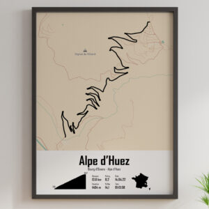
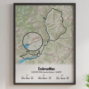
Finally, for those looking for a lasting souvenir of their journey between peaks and valleys, this artistic poster of the GR10 captures the spirit of the path. It’s the perfect motivation for your next escape!
Conquered in advance? The GR®10, this legendary crossing of the Pyrenees, requires meticulous preparation. Every detail counts, from the choice of itinerary, to the right equipment and strategic stages. This extraordinary adventure is much more than a hike: it’s an opportunity to push your limits – while immersing yourself in breathtaking panoramas. So, would you like to strap on your crampons for this unforgettable experience?
FAQ
What are the best times of year to do the GR10, and how do weather conditions vary with the season?
The ideal time to undertake the GR10 is generally between late June and September, with summer often considered the most favorable season. It’s important to note that weather conditions can vary considerably.
In spring, the weather is often unstable, with thunderstorms and heavy showers. In summer,thunderstorms alternatewith periods of fine weather, and the weather is often better at higher altitudes. Some areas may remain snow-covered well into the season. So it’s vital to check with mountain professionals before you leave.
What criteria should you consider when choosing between the GR10 and GR11, depending on your preferences in terms of scenery and difficulty?
The choice between the GR10 and GR11 depends on your preferences in terms of scenery, difficulty and logistics. The GR10, entirely on the French side, offers varied scenery and is generally well developed. The GR11, on the other hand, crosses Spain and Andorra, with more rugged sections but a sunnier climate.
The GR10 is busier, while the GR11 can offer more solitude. Wild camping is permitted on the GR10 (with restrictions), but theoretically forbidden on the GR11. Consider these aspects when choosing the itinerary that best suits your expectations and level of experience.
How to manage water on the GR10: which sources are reliable and how to purify water safely?
Water management is essential on the GR10. Water sources are varied, including natural springs, fountains and water points near refuges. It’s vital to find out about the availability of water on each stage and plan accordingly, as some sections may be short of water.
It is strongly recommended to purify water, even if it appears clean, to avoid contamination. Methods include purifying tablets, water filters andboiling. When in doubt, it’s always best to purify water, even fountain water.
What are the transport options to reach the starting point in Hendaye and leave Banyuls-sur-Mer at the end of the GR10?
To reach Hendaye, the starting point of the GR10, you have several options: train (SNCF or Eusko Tren), bus (Hegobus or BlaBlaCar network), car, sea shuttle or cab. The train is often considered the most comfortable option.
To leave Banyuls-sur-Mer, you can take the train (SNCF station), the bus (line 540 to Perpignan), a taxi/VTC, opt for carpooling, or fly toGirona airport, 100 km away.
How can I obtain a “pass’port” from the Association Les Amis Gr’distes and what are the advantages of having it stamped at the refuges?
To obtain the “pass’port” from the Association Les Amis Gr’distes, you can purchase it via their online store. The association aims to help hikers prepare for their GR10 crossing. This “pass’port” serves as a crossing certificate, similar to the credential for the Camino de Santiago de Compostela.
The advantage of having the “pass’port” stamped at the refuges is that you keep a tangible souvenir of your GR10 crossing. It’s a way of collecting evidence of your passage and reliving your adventure through the stamps of the various places you visited.
How can you adapt your diet during the GR10 to optimize your energy and avoid digestive problems linked to physical effort and altitude?
To optimize your energy and avoid digestive problems during the GR10, opt for a diet rich in carbohydrates, moderate in fat and limited in protein. Carbohydrates are essential for energy, while proteins can be consumed moderately in the evening.
It’s important to manage your energy reserves without carrying too much heavy food. Eat energy bars, dried fruit and cereals throughout the day. In the event of altitude-related digestive problems, take preventive measures and find out more about the specific nature of these problems in athletes.