Discover France's most beautiful cycling passes
France is a paradise for cycling enthusiasts. With its varied landscapes and numerous mountain roads, it offers great challenges for cycling enthusiasts. Mountain passes are popular destinations for cyclists because of their breathtaking views, steep slopes and Tour de France legends.
Here are the 10 most beautiful cycling passes in France that we’ve selected for you:
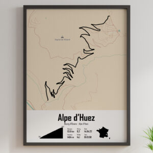
Iseran pass
Located in the Auvergne-Rhône-Alpes region and the Savoie département, the Col de l’Iseran is Europe’s highest road pass at 2,764 meters. The pass is 48 kilometers long, with an average gradient of 4.5% and a maximum gradient of 12%.
Galibier pass
Located in the Auvergne-Rhône-Alpes region and the Hautes-Alpes département, the Col du Galibier is one of the most legendary cycling passes in the French Alps. It rises to an altitude of 2,642 metres and offers breathtaking views of the surrounding mountains. The pass is 34 kilometers long, with an average gradient of 5.5% and a maximum gradient of 12%.

Col de la Bonette
Located in the Provence-Alpes-Côte d’Azur region and the Alpes-Maritimes département, the Col de la Bonette is France’s highest road pass, at 2,802 meters above sea level. The road to the pass offers spectacular views of the surrounding mountains. The pass is 23 kilometers long, with an average gradient of 6.6% and a maximum gradient of 14%.
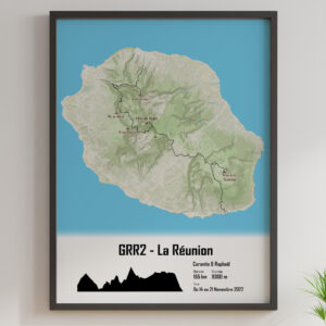
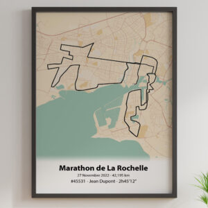
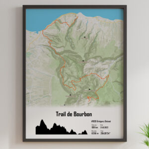
Discover our posters of France's most beautiful cycling passes.
Products Not Found
Tourmalet pass
Located in the Occitanie region and the Hautes-Pyrénées département, the Col du Tourmalet is one of the Tour de France’s most famous cycling passes. At an altitude of 2,115 metres, the pass offers breathtaking views of the surrounding mountains. The pass is 19 kilometers long, with an average gradient of 7.4% and a maximum gradient of 10.2%.
Col d'Izoard
Located in the Provence-Alpes-Côte d’Azur region and the Hautes-Alpes département, the Col d’Izoard is a legendary Tour de France cycling pass. At an altitude of 2,360 metres, the pass offers breathtaking views of the surrounding mountains. The pass is 14.1 kilometers long, with an average gradient of 7.3% and a maximum gradient of 10%.
Mont Ventoux
Mont Ventoux, located in the Vaucluse department of the Provence-Alpes-Côte d’Azur region, is one of France’s most famous cycling passes. With a height of 1912 metres, it is also known as the “Giant of Provence”.
Mont Ventoux is known for its total length of 21.5 km and vertical drop of 1,570 metres. Cyclists can climb this mountain via three main routes: the Route des Cèdres, the Route de Malaucène and the Route de Bédoin. The Route de Bédoin is the most popular and the most difficult, with an average gradient of 7.5% and a maximum gradient of 12%.
Mont Ventoux is a place steeped in cycling history. It hosted the Tour de France for the first time in 1951 and has been the scene of numerous battles between legendary cyclists such as Eddy Merckx and Chris Froome. It is also known for its natural beauty, with panoramic views of the surrounding mountains and the Rhône valley.
Col de la Madeleine
The Col de la Madeleine is located in the French Alps, in the Auvergne-Rhône-Alpes region, and more precisely in the Savoie département. It links the Tarentaise and Maurienne valleys, two regions famous for their renowned ski resorts.
The Col de la Madeleine is 19.2 kilometers long and rises to an altitude of 1,993 metres. It offers breathtaking views of the surrounding peaks, including Mont Blanc and La Vanoise. The average gradient of the ascent is 7.6%, with passages of up to 10% in some sections. The maximum percentage is 11%.
The Col de la Madeleine is one of the Tour de France’s legendary cycling passes, crossed more than 25 times since its first appearance in 1969.
Aubisque pass
The Col d’Aubisque is located in the Nouvelle-Aquitaine region, in the Pyrénées-Atlantiques. It is approximately 16.6 kilometers long and has an altitude of 1,709 metres. The average percentage of the climb is 7.2%, with some passages at 9-10%, and the maximum percentage is 13%.
Col de Peyresourde
The Col de Peyresourde is located in the Occitanie region of the Pyrenees, straddling the departments of Haute-Garonne and Hautes-Pyrénées. It has a total length of 15.3 kilometers and an altitude of 1,569 metres. The average percentage of the climb is 7.1%, with passages at 8-9%, and the maximum percentage is 10%.
Portet pass
Pyrenees. It has a total length of 16.3 kilometers and an altitude of 2,215 metres. The average percentage of the climb is 8.7% with passages at 10-11% and the maximum percentage is 16%.
The Col de Portet is a fearsome climb for cyclists, and was included for the first time on the Tour de France route in 2018.
Col du Grand Colombier
The Col du Grand Colombier is located in the Auvergne-Rhône-Alpes region, in the Ain département. It has a total length of 17.4 kilometers and an altitude of 1,501 metres. The average percentage of the climb is 7.2% with passages at 10-12% and the maximum percentage is 22%.
The Col du Grand Colombier is one of France’s most difficult cycling passes for cyclists, and is often included on the Tour de France route. It offers spectacular views of the surrounding mountains and Lac du Bourget.
Illustrate your climbing memories with our cycling pass posters
Products Not Found
| Pass name | Region | Department | Length | Altitude | Average percentage | Maximum percentage |
|---|---|---|---|---|---|---|
| Iseran pass | Auvergne-Rhône-Alpes | Savoie | 16.8 km | 2 764 m | 6,9 % | 12 % |
| Galibier pass | Auvergne-Rhône-Alpes | Savoie/Hautes-Alpes | 34.8 km | 2 645 m | 5,5 % | 12 % |
| Col de la Bonette | Provence-Alpes-Côte d’Azur | Alpes-Maritimes | 23.2 km | 2 802 m | 6,6 % | 10,2 % |
| Col d’Izoard | Provence-Alpes-Côte d’Azur | Hautes-Alpes | 14.1 km | 2 361 m | 7,1 % | 10,1 % |
| Mont Ventoux | Provence-Alpes-Côte d’Azur | Vaucluse | 21.5 km | 1 909 m | 7,5 % | 12 % |
| Col de la Madeleine | Auvergne-Rhône-Alpes | Savoie | 19.2 km | 1 993 m | 8,1 % | 12 % |
| Tourmalet pass | Occitanie | Hautes-Pyrénées | 19 km | 2 115 m | 7,4 % | 10,2 % |
| Aubisque pass | Nouvelle-Aquitaine | Pyrénées-Atlantiques | 16.6 km | 1 709 m | 7,1 % | 13 % |
| Col de Peyresourde | Occitanie | Haute-Garonne/Hautes-Pyrénées | 15.3 km | 1 569 m | 7,8 % | 13,2 % |
| Portet pass | Occitanie | Hautes-Pyrénées | 16 km | 2 215 m | 8,7 % | 16 % |