Course Highlights — Marathon du Mont-Blanc 42km 2026 Kilometre by Kilometre
Four sections, two sides of the mountain, a race decided as much in the head as in the legs. The 42km du Mont-Blanc is a management race — the profile climbs progressively to mid-point, then descends. But the progressiveness is deceptive: the climb to the Aiguillette is steep, the terrain technical, and snow can appear on the rocks from 1,800 m upwards.
The Valley Climb — Chamonix to Argentière (km 0 – 12)
7:15am, start from the Place du Triangle de l’Amitié in Chamonix (1,035 m). The late June sun is already up, the crowds are out — the Marathon du Mont-Blanc is one of the most watched events on the global trail calendar. The first kilometres leave from the paragliding launch area, climbing gently up the Chamonix valley toward the north-east. The route passes through the hamlets of Les Bois and Le Lavancher before reaching Argentière (~1,250 m) around km 10–12. This section is relatively accessible: mixed terrain, moderate elevation, woodland and balcony paths. It is the settling-in section — managing the excitement of a 7am start in a world-class race with Mont-Blanc lit up to the east. Start below your target pace. The climb coming after Argentière does not forgive hot starts.
The Technical Climb — Tête du Prapator and Petit Balcon Nord (km 12 – 24)
After Argentière, the route gains altitude sharply, leaving the valley floor for the flanks of the Aiguilles Rouges Nature Reserve. This massif, on the opposite side of the Chamonix valley from Mont-Blanc, is one of the best-preserved alpine natural sanctuaries in France — chamois, ibex, marmots and exceptional subalpine flora. The trail climbs to the Tête du Prapator then follows the Petit Balcon Nord — a panoramic balcony path at altitude with sweeping views down into the Chamonix valley and across to the Argentière glacier. The terrain changes completely from the first section: narrow single tracks, tricky roots, rocky passages, exposed traverses. This is where the real trail runners separate from the pack. Watch your footing, not the panorama — the temptation is immense, the terrain unforgiving.
Aiguillette des Posettes — The Race’s Judge (km 24 – 28)
The Aiguillette des Posettes (~2,100 m) is the main difficulty — and the highlight — of the Marathon du Mont-Blanc. The final climb to this summit is steep, demanding and magnificent: pure alpine terrain with scree sections, possible residual snow in late June, and a 360-degree view over the Mont-Blanc massif from the north. A view that is worth every metre of suffering. It is the course’s high point, reached around mid-race for faster runners. The turnaround comes a few hundred metres before the Swiss border — a frustrating tease for anyone curious about what lies on the other side, but also one of the quirks of a route that brushes Switzerland without entering it. Refuel at the final aid station, check your kit for the descent, and take one last look at the panorama: the return to Chamonix is pure racing mode.
The Descent — Back to Chamonix (km 28 – 42)
The descent from the Aiguillette des Posettes to Chamonix packs approximately 2,500 m D- into 14 km — a serious mechanical challenge for quadriceps that have already climbed 2,500 m. This is where results are made, for elites and amateurs alike. Legs that managed the climb well will fly on the descent; legs that overcooked at the start or on the Petit Balcon Nord will cramp. The technical terrain of the Aiguilles Rouges descends differently from how it ascends: narrow singles become precision lances where every footfall counts. On the last kilometres into the valley toward Chamonix, the terrain eases and pace naturally rises. The finish at the Place du Triangle de l’Amitié, with crowds, Mont-Blanc as a backdrop and festival atmosphere, is one of the most beautiful in world trail running.
Course Summary — Kilometre by Kilometre
| Section |
Key locations |
Profile and terrain |
| 0 – 12 km |
Chamonix (1,035 m), paragliding area, Les Bois, Le Lavancher, Argentière (~1,250 m) |
Progressive climb, varied, woodland and balcony paths |
| 12 – 24 km |
Aiguilles Rouges Nature Reserve, Tête du Prapator, Petit Balcon Nord |
Technical single tracks, rocky terrain, panoramic balcony |
| 24 – 28 km |
Aiguillette des Posettes (~2,100 m) — high point — turnaround before Swiss border |
Steep climb, scree, possible snow, turning point |
| 28 – 42 km |
Descent Aiguilles Rouges, Petit Balcon Nord, return Argentière to Chamonix — Place du Triangle de l’Amitié |
Technical then rolling descent, finish in town |
Elevation Profile
With 2,540 m of elevation gain across 42 km, the Marathon du Mont-Blanc 42km is the most demanding trail race at marathon distance in this article cluster — 60 m D+/km, compared to 27 m/km for Les Chibottes or 4.5 m/km for the Stockholm Marathon. The profile is an asymmetric dome: the climb is progressive across 28 km, the descent is concentrated and steep over 14 km. Start and finish altitude is approximately 1,035 m (Chamonix). The high point is the Aiguillette des Posettes at around 2,100 m. The course frequently sits between 1,500 m and 2,100 m altitude — an elevation that can affect ventilation for runners not acclimatised, particularly on the Petit Balcon Nord and the final ascent.
Key warnings for the Marathon du Mont-Blanc 42km 2026: four factors to anticipate. First: altitude. Running between 1,500 m and 2,100 m places different demands on the cardiovascular system — if you are coming from low altitude, aim to arrive in Chamonix the day before at minimum. Second: snow. Residual snow patches are possible at the Aiguillette des Posettes in late June. The mandatory kit list accounts for this (gloves, warm hat, thermal clothing). Third: mountain weather. Conditions can change rapidly at 2,100 m — waterproof jacket mandatory in the pack. Fourth: the descent. 14 km of technical descent on already-worked quadriceps — the majority of race retirements and injuries on this format happen on the way down, not the way up.
Race Strategy for the Marathon du Mont-Blanc 42km 2026
The dome profile of the 42km calls for a different strategy from a standard trail. The progressive climb to mid-race should not mask its reality: 2,540 m D+ represents a major muscular investment, especially where technical terrain tires the ankle stabilisers. The descent is a discipline in its own right — not a recovery section.
The Valley Climb: Settle In, Don’t Attack
The first 12 km to Argentière are inviting: accessible terrain, festival atmosphere, fresh body at 7am. This is exactly where future cramps are decided. Target heart rate from km 1, poles in hand if you carry them (permitted and recommended), fuel from 45 minutes into the race even without hunger. Use the scenery to self-regulate: running facing Mont-Blanc, staying calm feels almost instinctive.
Petit Balcon Nord: Technique Before Speed
On the single tracks of the Petit Balcon Nord (km 12–24), the rule is absolute: foot placement takes priority over movement speed. A misstep on a root or rock block can compromise the descent 15 km later. Shorten the stride, drop your gaze to 3–4 metres ahead of you, and hold your FC constant on the climbs even if it means walking.
The Aiguillette: Climb Slowly, Descend Precisely
The final push to the Aiguillette des Posettes (km 24–28) is the 42km’s defining test. Walk without ego any gradient above 20% — even the elites do it on this section. Refuel at the last aid station before the high point. On the descent (km 28–42): ultra-short stride for the first technical kilometres, knees slightly bent, eyes forward. Accelerate progressively as the terrain eases toward Argentière and Chamonix — the final 5 km can be run at near road-marathon pace if you have managed the rest correctly.
The Marathon du Mont-Blanc and the Golden Trail World Series
The 42km du Marathon du Mont-Blanc is a Golden Trail World Series race — the world’s reference circuit for elite trail performance, gathering the world’s best trail runners at a selection of iconic events. In 2026, the top finishers H and F in the 42km accumulate GTWS ranking points, opening the door to the season’s finals. It is one of the rare races where world trail champions share a start line with amateur runners — a coexistence unique in outdoor sport. Having the same race number as Kilian Jornet or Mathieu Blanchard, even if the time gap is considerable, is something that cannot be manufactured.
Practical Information
Getting There — Eco Travel
- By train (recommended — 40% of entries reserved): from Geneva (~1h by TER), Lyon (~3h via Annecy), Paris (~5h30 by TGV + TER). Chamonix-Mont-Blanc station is 10 min walk from the Place du Triangle de l’Amitié
- By bus: regular services from Geneva Airport (1h15, Sat’Bus and others)
- By car: A40 from Lyon or Geneva, exit Chamonix. Allow for road closures on Sunday morning
- Internal shuttles: free shuttles between event venues — check the mobility plan on marathonmontblanc.fr
Bib Collection — 42km
- Location: EMC2 space, Place du Mont-Blanc, Chamonix
- Date: Saturday 27 June 2026, 9am–9pm
- By appointment only — book via the official website
- Photo ID mandatory — bibs issued in person only
- No collection on Sunday morning
Mandatory Kit (semi-autonomous, high mountain)
- Water supply: 1.5 litres minimum
- Charged mobile phone
- Survival blanket, whistle
- Waterproof jacket with hood
- Warm clothing, gloves, hat (snow and wind possible at 2,100 m)
- Headtorch + spare batteries
- Full list on marathonmontblanc.fr
Weekend Schedule
- Thursday 25 June: Trail Camp and Expo, bib collection
- Friday 26 June: Trail Camp, bib collection, 90km start at 4:45am
- Saturday 27 June: KM Vertical start at 4pm, 42km bib collection (9am–9pm)
- Sunday 28 June: 23km start 8am, 10km start 10:30am, 42km elite women 6:45am / main field 7:15am, first finishers ~10:45am, prize giving 5pm
FAQ — Marathon du Mont-Blanc 42km 2026
Where does the Marathon du Mont-Blanc 2026 start?
The race starts on Sunday 28 June 2026 from the Place du Triangle de l’Amitié in Chamonix: elite women at 6:45am, main field at 7:15am. This is also the finish (loop course). Chamonix-Mont-Blanc train station is a 10-minute walk away.
What is the main difficulty of the 2026 course?
The Aiguillette des Posettes (~2,100 m) is identified by the organisation as the “main difficulty” of the 42km. This final alpine climb — scree, exposed passages, potential snow — arrives at approximately mid-race and concentrates the greatest elevation change over the shortest distance. This is where races are made and lost.
Is the Marathon du Mont-Blanc a Golden Trail World Series race?
Yes. The 42km du Marathon du Mont-Blanc is a 2026 Golden Trail World Series race — the world reference circuit for elite trail performance. The world’s best trail runners compete here. All finishers share the same start and finish, regardless of pace.
Is there snow on the course in June?
Yes, residual snow patches are possible on sections above 1,800–2,000 m, particularly near the Aiguillette des Posettes. Late June does not guarantee a fully snow-free route at this altitude. The mandatory kit list accounts for this: gloves, hat and warm clothing are required in your pack.
What is the eco-travel policy for the Marathon du Mont-Blanc 2026?
Following a study showing that 96% of the event’s carbon footprint comes from participant travel, the organisation has introduced a pioneering system: 40% of main-distance entries are reserved for participants arriving by train or bus. A world first in trail running, reflecting a Chamonix valley reinventing itself for sustainability.
What is the time limit for the 42km du Mont-Blanc?
Cut-off times are set at each aid station and must be respected strictly. The full cut-off list for 2026 is on the official website. The overall race window allows first finishers from 10:45am, with the prize giving at 5:00pm.
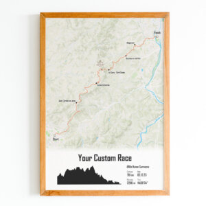
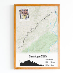
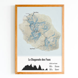
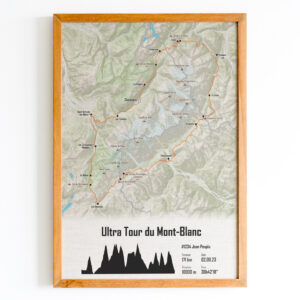
Celebrate Your Marathon du Mont-Blanc 2026 with The Post Trace
42 km facing Mont-Blanc, 2,540 m of climbing through the Aiguilles Rouges Nature Reserve, the Aiguillette des Posettes at 2,100 m, snow underfoot in June, and the finish on the Place du Triangle de l’Amitié in front of thousands of spectators. This trail marathon is an epic — it deserves a memory to match.
At The Post Trace, we turn your GPS trace into a hand-crafted map poster made in Lyon on recycled paper. Your exact Chamonix-to-Aiguillette-and-back loop, your race number, your finish time — a unique keepsake to hang, gift or keep.
You May Also Like